GeoDrones project has been focusing on
- Developing drone and sensor infrastructure, including remote sensing geophysical sensors, allowing for high resolution surface and subsurface mapping. See the range of our drone platforms and sensors.
- Developing automated data processing workflows based on open-source libraries (Python and R) to streamline photogrammetry and GPR data processing and interpretation.
- Apply the developed methods to different applications including:
- Snow mapping and avalanche forecasting
- Glaciology
- Archeology
- CO2 storage and leakage monitoring
- Natural hazards

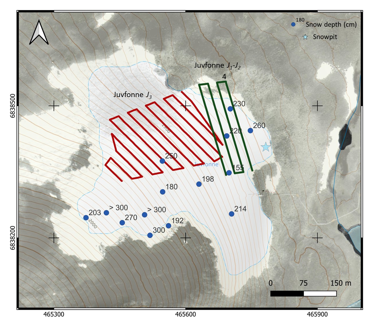
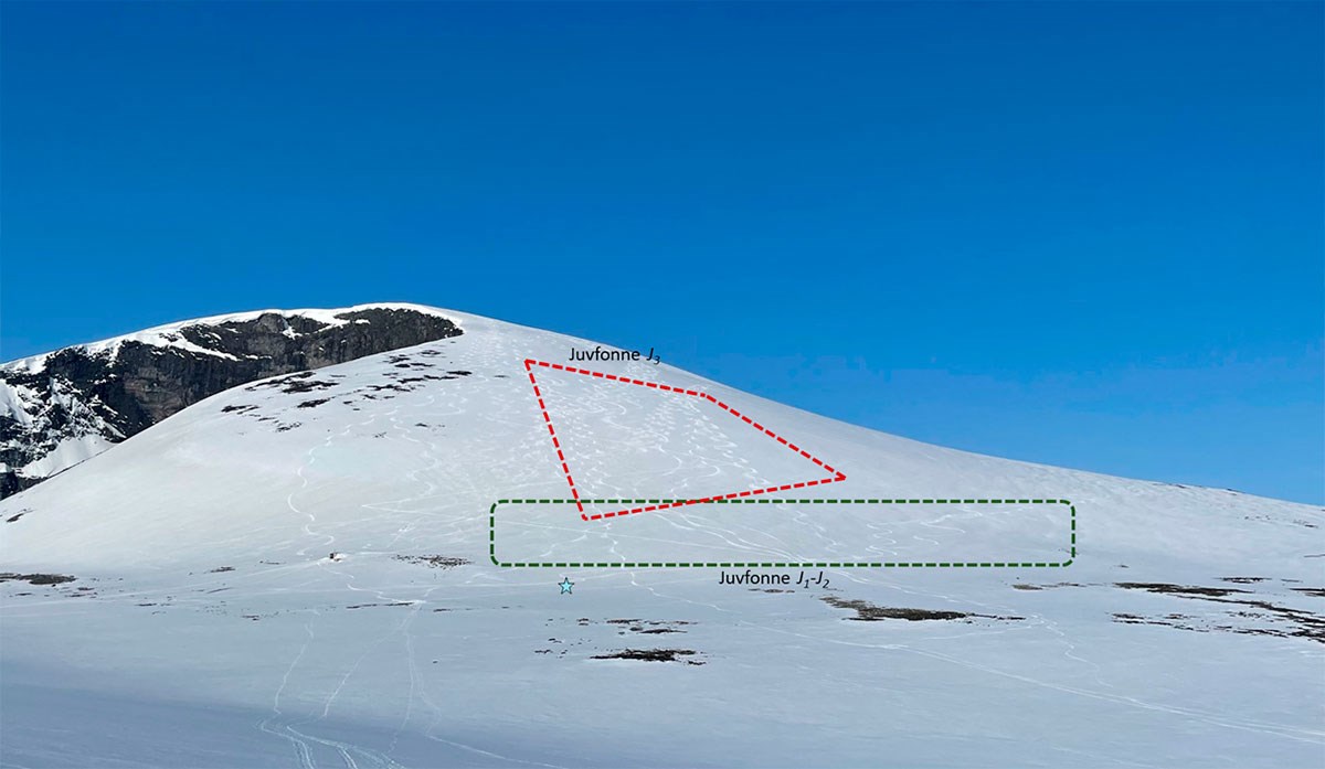
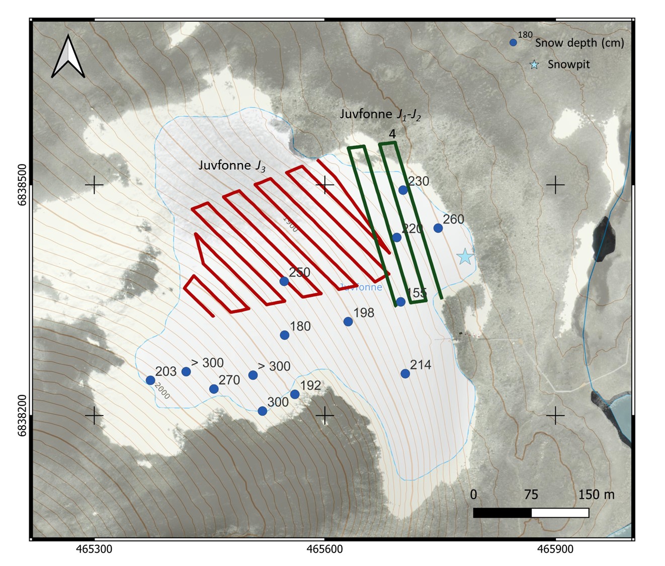
Test sites: Juvfonne
Data was acquired with DJI Matrice 300 drone and with Radsys Aero LF 75, 150 and 400 MHz GPR antennas.
- Up to 192 m long profiles
- Optimized flights
- 20 m line spacing
- Wet to very wet snow: high attenuation
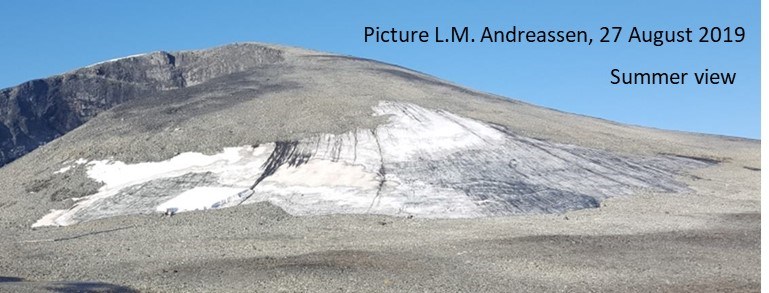
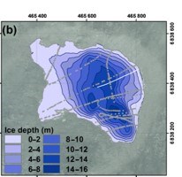
- Ice patch (small glacier, 0.086 km2) with up to 16 m ice thickness (2017)
Full scale survey
Flight characteristics with one battery set.
- Juvfonne
- Steep terrain: 20-35 degrees
- 150 MHz antennas
- 2 m/s flight speed
- 3 m altitude
- 10-12 m/s wind gusts
- 21 min (25 min total)
- One set of batteries
- 2.2 km long
- Covered area = 3.85 ha with 20m line spacing
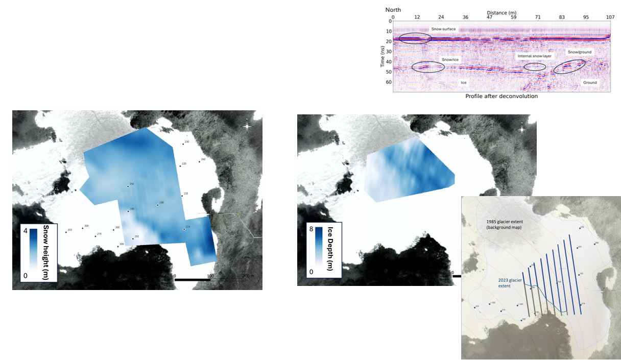
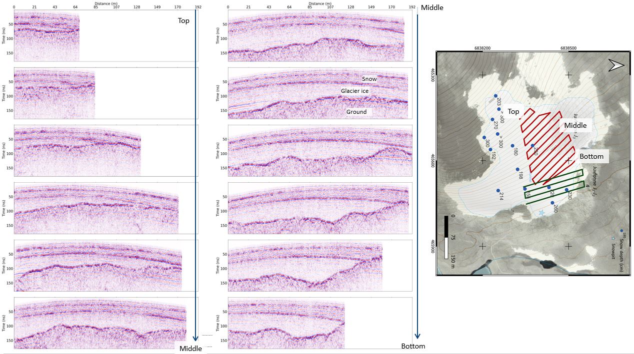
Examples of GPR data with 75 MHz antenna where the snow layer and the glacier ice can be clearly mapped.
Glacier mass balance, ice thickness changes
Derived snow height and glacier ice depth from spatial interpolation of the GPR data.